Static Maps vs. Web Maps
What’s the best way to tell your story?
Static maps
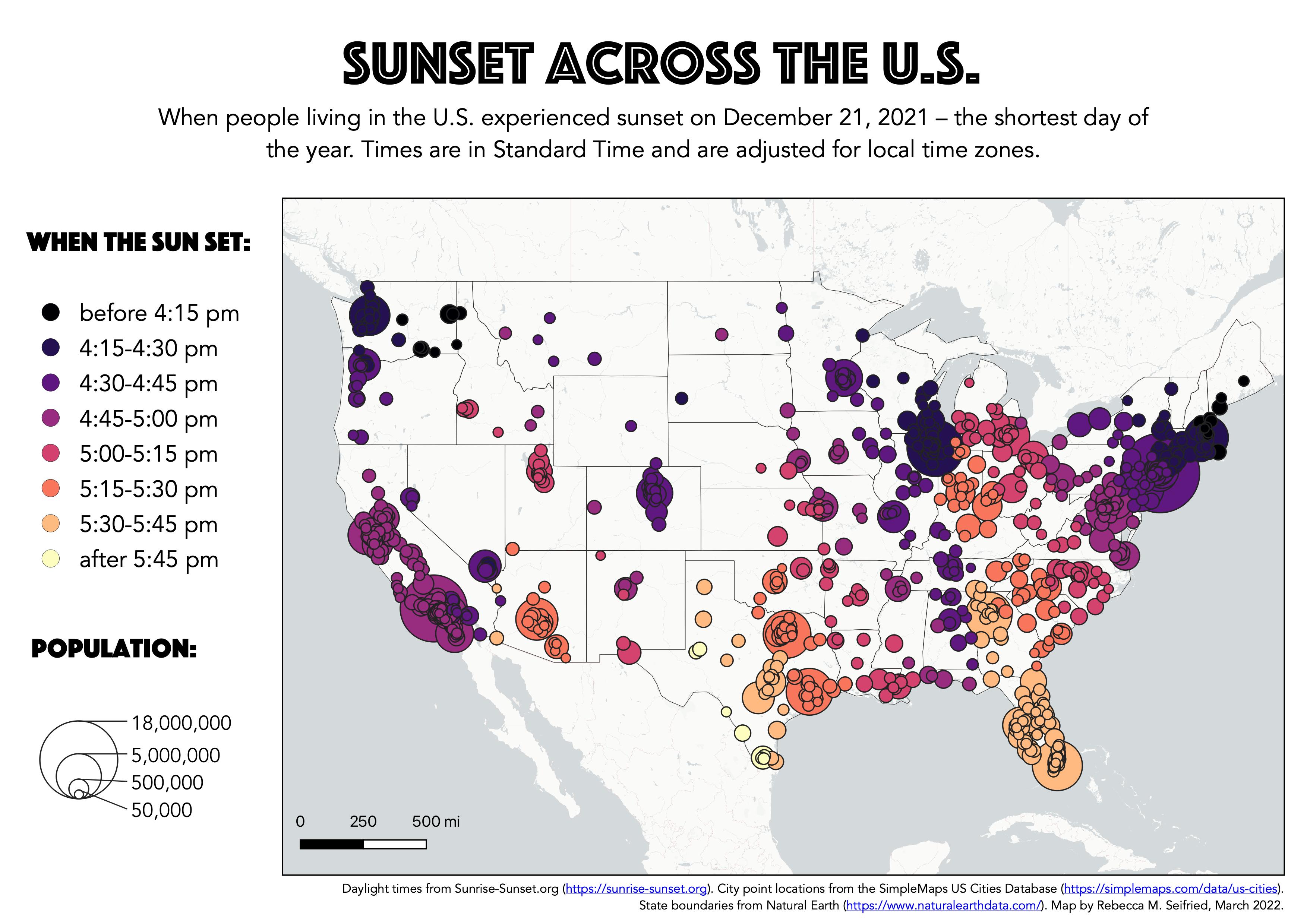
Let’s say you’re a big fan of the sun, and you are curious about how people’s experience of daylight varies across the U.S. You could collect data about sunset times and create a static map to print out or post online.
Web maps
Or you could turn this map into a web map.
Web Map: Sunset Across the U.S.
Web maps are great ways to share data with others in a visually exciting and interactive way. The great power of web maps (vs. printed or static maps) is that users can zoom, pan, click, search, and explore the data in new ways.
Comparing the two
| Static Maps | Web Maps | |
|---|---|---|
| Layers | Realistically only a few can be included on a single map without becoming overly complex | Additional layers can be included and toggled on/off |
| Data visualization | Predetermined way of visualizing data based on the map maker’s preferences | Can allow for interactivity in how data is display using filters, on/off toggles, or ability to change symbology |
| Interactivity | Paper can feel nice? | Users can zoom, pan, click, toggle on/off, and search |
| Map composition | Easy to add text, map elements, credits, etc. in layout manager | Requires configuring the map session preferences or editing the HTML file after production |
| Sharing | Image can be exported and shared as a standalone file | URL can be shared as a link and viewed on tablets, phones, or computers |
If a web map would be a good way to tell your story, check out the exercise to get started!