Example Maps
Curated maps that highlight cartographic best practices
For each of these maps, ask whether it meets the assessment criteria in the How to Design Your Own Map guide:
- Is it easy to identify important information?
- Is the layout balanced?
- Does the map take into account optical center and natural eye movement?
- Is it accessible?
- Does it abide by the Cartography Code of Ethics?
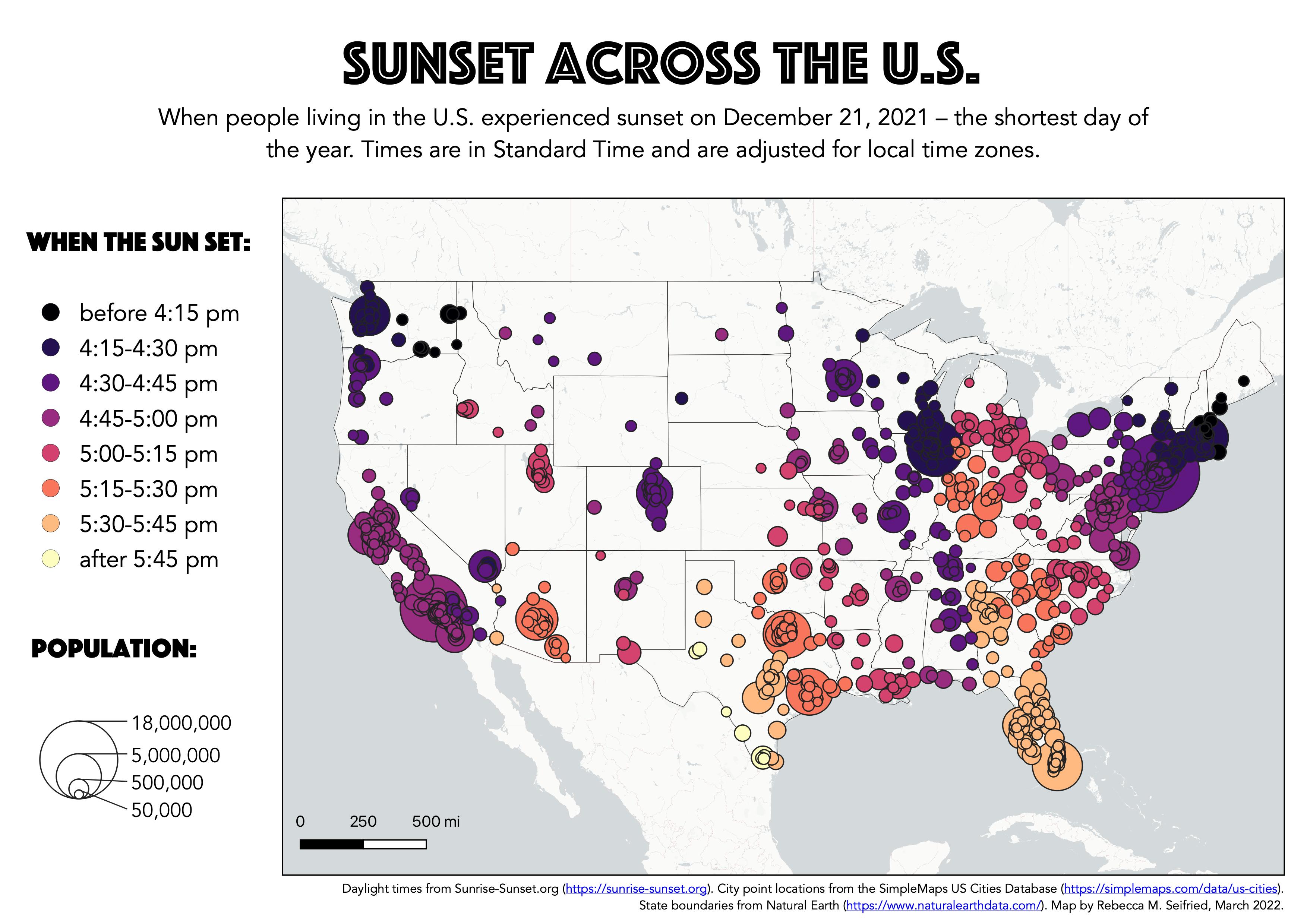
Sunset Across the U.S.
Map by Rebecca M. Seifried, 2022. Designed for the “Build a Web Map” workshop on this site. View the original map.
Blue Jay
Map by Wanmei L (@MapsbyW), 2022. View on Twitter.

Seventy Years of Canadian Wildfire: 1950 to 2020
Map by Glenn Ingram, 2022. Submitted to the Esri User Conference 2022 by the GIS Certification Institute. View the original map.

Buildings of Yelahanka Satellite Town and Vicinity
Map by @thedivtagguy, 2021. Check out their tutorial, Visualizing Pretty Building Footprints with QGIS.

Two Nations, Over the Air
Map by Tim Wallace, 2011. View the original map.

UFO Sightings Since 1925
Map by John Nelson, 2015. View the original map.
